 Smoke over Williams
Saturday, October 10, 2009
Oktoberfest at Williams
Flew about 2 hours, and ended up landing out on Willows. The condition was very marginal. There was fire in the valley, and it was very smoky on my way back.
 Smoke over Williams
Smoke over WilliamsSaturday, September 26, 2009
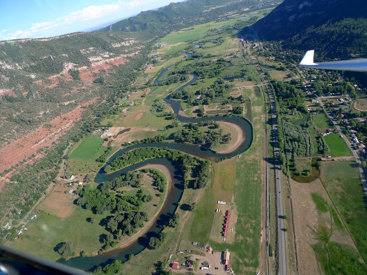
Gliding back from T15
Flew about 3 hours at Williams. The highlight of this flight was coming back from T15 (about 85 miles away from Williams) in one glide from 15,000 ft.
 Stonyford and East Park Reservior
 Stonyford and East Park Reservior
Saturday, September 19, 2009
Summary of Gliding and National Parks Trip 2009
This is the summary of my Gliding and National Parks trip this summer from June 26th to September 13th.
Days spent: 80 days 79 nights
Glider sites visited: 11 (Truckee, Ely, Parowan, Durango, Moriarty, Boulder, Logan, King Mountain, Hamilton, Kalispell, Crazy Creek)
Flights flown: 28
Hours flown: 125 hours (avg 4:28 per flight)
Distance flown: 9116 km (avg 326km per flight)
Landouts: 4
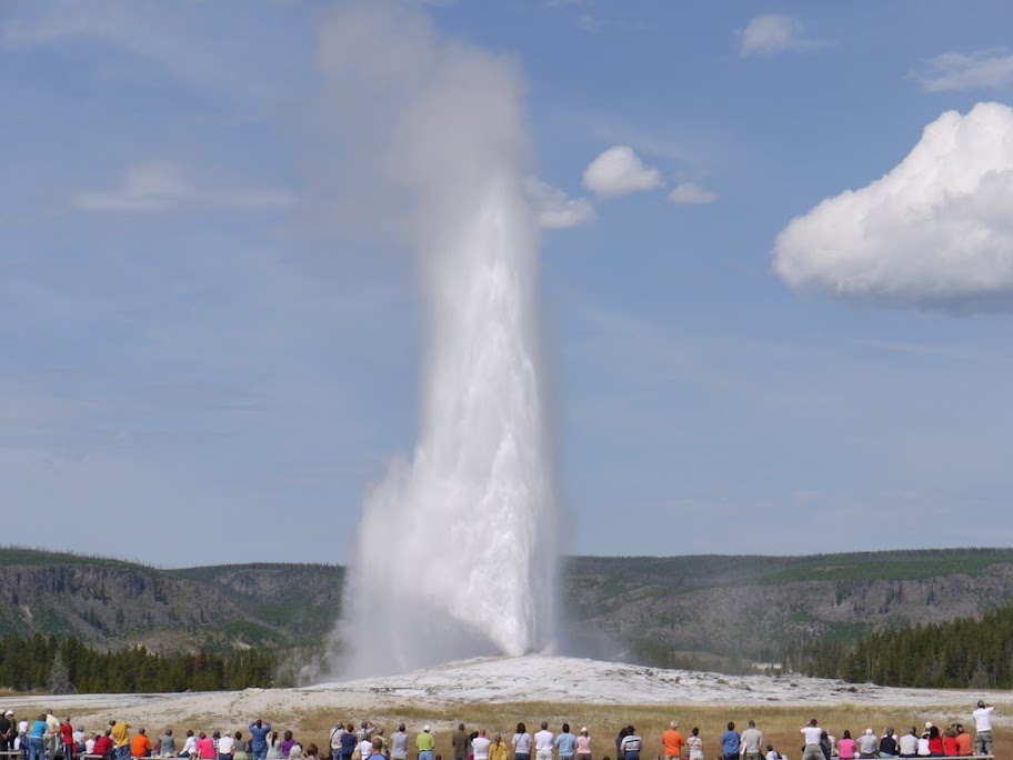
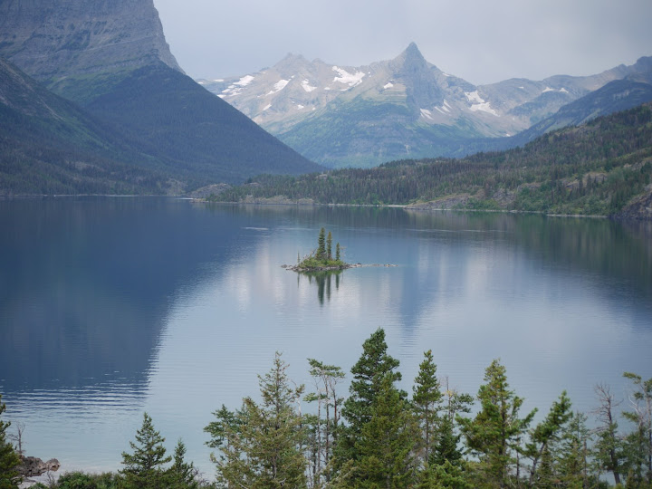
National Parks flown over: 9 (Yosemite, Grand Canyon, Bryce Canyon, Zion, Capitol Reef, Canyonlands, Yellowstone, Rocky Mountain, Glacier)
National Parks visited by ground: 7 (Great Basin, Zion, Canyonlands, Yellowstone, Grand Teton, Glacier, Crater Lake)
Miles driven: 6,100 miles
Photos taken: 3,000+
The trace of this trip

A(Q) = Sunnyvale, CA
B = Truckee, CA
C = Ely, NV
D = Parowan, UT
E = Durango, CO
F = Moriarty, NM
G = Boulder, CO
H = Logan, UT
I(K) = Moore (King Mountain), ID
J = Yellowstone, WY
K = Moore (King Mountain), ID
L = Hamilton, MT
M = Kalispell, MT
N = Bend, OR
O = Middletown (Crazy Creek), CA
P = Williams, CA
Q = Sunnyvale, CA
Glider Sites Visited
Soar Truckee (Truckee, CA)
Ely Soaring Center (Ely, NV)
Parowan Aero Services (Parowan, UT)
Durango Soaring Club (Durango, CO)
Sundance Aviation (Moriarty, NM)
Mile High Gliding (Boulder, CO)
King Mountain Glider Park (Moore, ID)
Wave Soaring Adventures (Hamilton, MT)
Red Eagle Aviation (Kalispell, MT)
Crazy Creek Air Adventures (Middletown, CA)
National Parks Visited
Yosemite National Park, CA
Great Basin National Park, NV
Zion National Park, UT
Canyonlands National Parks, UT
Bryce Canyon National Park, UT
Capitol Reef National Park, UT
Yellowstone National Park, WY
Grand Teton National Park, WY
Rocky Mountain National Park, CO
Glacier National Park, MT
Crater Lake National Park, OR
Blog or album entries
Some photos and videos from this trip
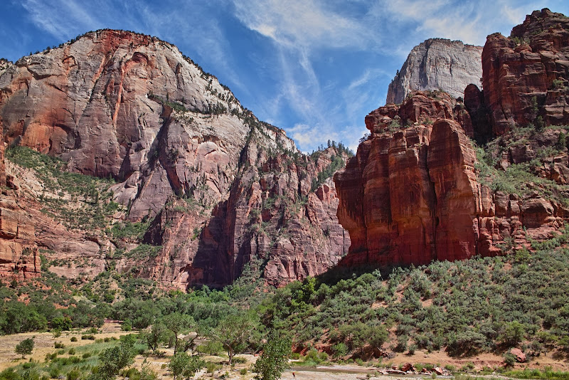
Zion National Park, UT (7/8)
Flying over Grand Canyon, Zion, and Bryce Canyon National Parks (7/12)
Flying over Capitol Reef and Canyonlands National Parks (7/13)
Canyonlands National Park, UT (7/15)
The nice grass runway at Durango, CO (7/17)
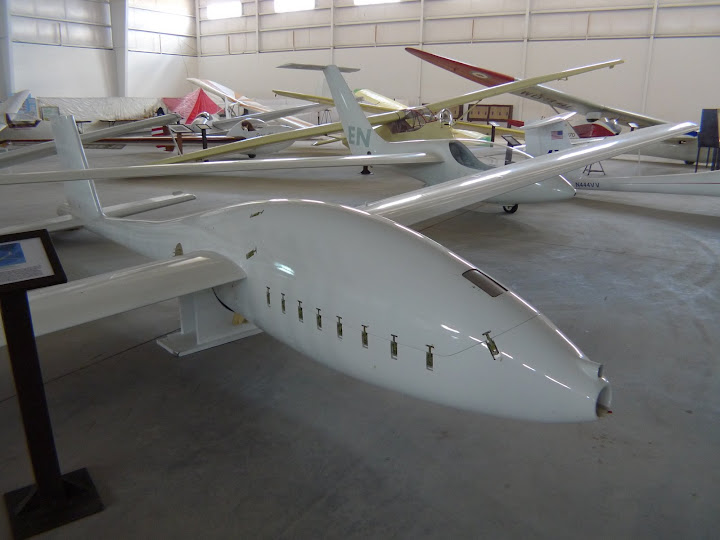
Soaring Museum in Moriarty, NM (7/20)
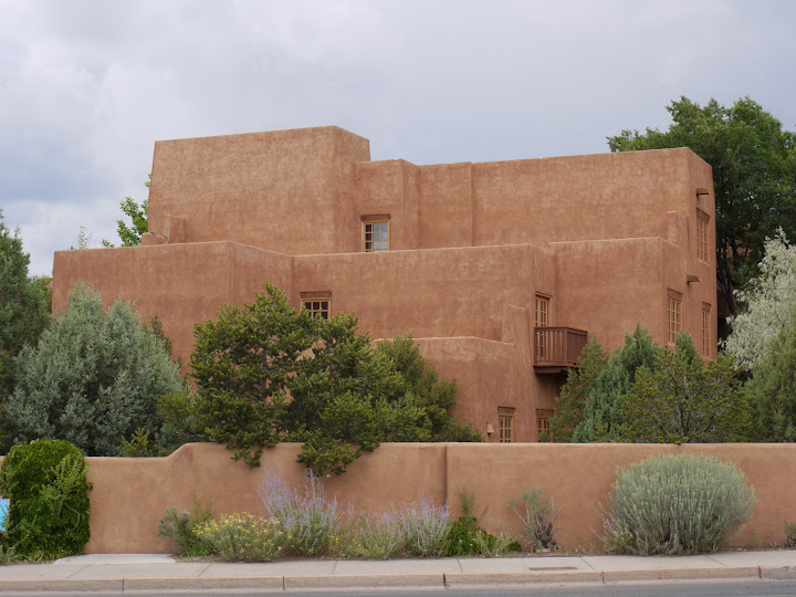
Santa Fe, NM (7/21)
Yellowstone National Park, WY (8/24)
Yellowstone National Park, WY (8/30)
Glacier National Park, MT (9/5)
Flying over Glacier National Park, MT (9/10)
Crater Lake National Park, OR (9/12)
A mountain wave flight in Middletown, CA (9/13)
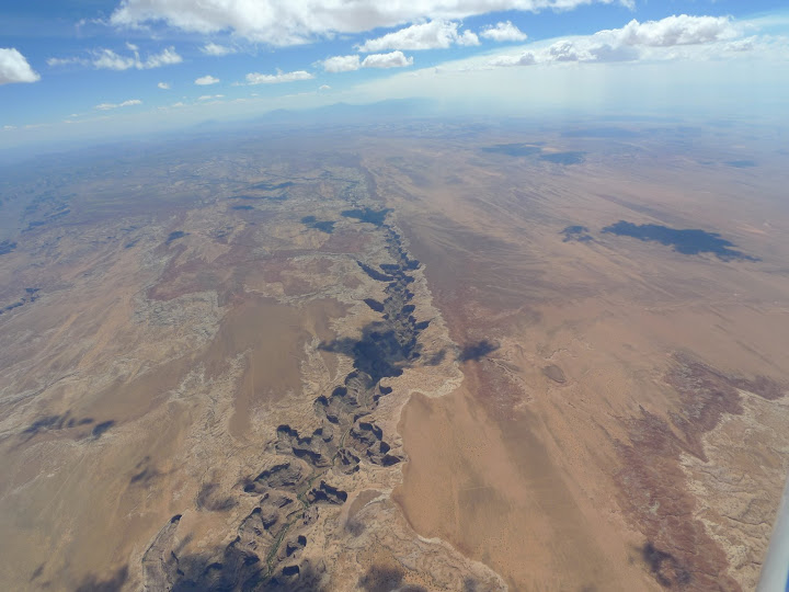
Flying over Capitol Reef National Park. Very dry, but very beautiful land. My favorite feature is San Rafael Reef.
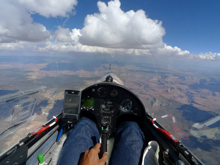
Flying over Grand Canyon.
More photos and videos can be found at my Picasa Web Albums and YouTube sites.
Sectional charts used for this trip

Days spent: 80 days 79 nights
Glider sites visited: 11 (Truckee, Ely, Parowan, Durango, Moriarty, Boulder, Logan, King Mountain, Hamilton, Kalispell, Crazy Creek)
Flights flown: 28
Hours flown: 125 hours (avg 4:28 per flight)
Distance flown: 9116 km (avg 326km per flight)
Landouts: 4
National Parks flown over: 9 (Yosemite, Grand Canyon, Bryce Canyon, Zion, Capitol Reef, Canyonlands, Yellowstone, Rocky Mountain, Glacier)
National Parks visited by ground: 7 (Great Basin, Zion, Canyonlands, Yellowstone, Grand Teton, Glacier, Crater Lake)
Miles driven: 6,100 miles
Photos taken: 3,000+
The trace of this trip

A(Q) = Sunnyvale, CA
B = Truckee, CA
C = Ely, NV
D = Parowan, UT
E = Durango, CO
F = Moriarty, NM
G = Boulder, CO
H = Logan, UT
I(K) = Moore (King Mountain), ID
J = Yellowstone, WY
K = Moore (King Mountain), ID
L = Hamilton, MT
M = Kalispell, MT
N = Bend, OR
O = Middletown (Crazy Creek), CA
P = Williams, CA
Q = Sunnyvale, CA
Glider Sites Visited
Soar Truckee (Truckee, CA)
Ely Soaring Center (Ely, NV)
Parowan Aero Services (Parowan, UT)
Durango Soaring Club (Durango, CO)
Sundance Aviation (Moriarty, NM)
Mile High Gliding (Boulder, CO)
King Mountain Glider Park (Moore, ID)
Wave Soaring Adventures (Hamilton, MT)
Red Eagle Aviation (Kalispell, MT)
Crazy Creek Air Adventures (Middletown, CA)
National Parks Visited
Yosemite National Park, CA
Great Basin National Park, NV
Zion National Park, UT
Canyonlands National Parks, UT
Bryce Canyon National Park, UT
Capitol Reef National Park, UT
Yellowstone National Park, WY
Grand Teton National Park, WY
Rocky Mountain National Park, CO
Glacier National Park, MT
Crater Lake National Park, OR
Blog or album entries
| Date | Location | Title |
|---|---|---|
| 6/27 | Truckee | Flight to Yosemite |
| 6/28 | Truckee | Sick day |
| 6/29 | Truckee | ODs... |
| 6/30 | On the road | Driving |
| 7/1 | Ely | No flight at Ely |
| 7/2 | Ely | Another rainy day at Ely |
| 7/3 | Ely | Great Basin National Park |
| 7/4 | Ely | Flight at Ely |
| 7/5 | Parowan | Flying over Capitol Reef National Park |
| 7/6 | Parowan | Second flight at Parowan |
| 7/7 | Parowan | No flight at Parowan |
| 7/8 | Parowan | Zion National Park |
| 7/9 | Parowan | The third day of no flying |
| 7/10 | Parowan | Just a local soaring |
| 7/11 | Parowan | Landing out on Milford |
| 7/12 | Parowan | Flight to Grand Canyon, Zion, and Bryce Canyon |
| 7/13 | Parowan | Canyonlands |
| 7/14 | Parowan | Last flight at Parowan, drove to Moab |
| 7/15 | Moab | Canyonlands National Park, meeting with Lou |
| 7/16 | On the road | Driving to Durango, CO |
| 7/17 | Durango | First flight at Durango, CO |
| 7/18 | Durango | Second day at Durango |
| 7/19 | On the road | Driving to Moriarty, NM |
| 7/20 | Moriarty | Soaring Museum |
| 7/21 | Moriarty | Santa Fe |
| 7/22 | Moriarty | No flight |
| 7/23 | Moriarty | Fourth day of no flight |
| 7/24 | Moriarty | Finally! A flight at Moriarity |
| 7/25 | Moriarty | Second flight at Moriarty |
| 7/26 | On the road | Driving to Boulder, CO |
| 7/27 | Boulder | First day at Boulder |
| 7/29 | Boulder | Visiting NCAR |
| 7/31 | Boulder | Visiting University of Colorado |
| 8/1 | Boulder | First flight at Boulder, CO |
| 8/2 | Boulder | A better day at Boulder |
| 8/3 | Boulder | Denver Tour |
| 8/7 | Boulder | Last flight at Boulder |
| 8/8 | On the road | Driving from Boulder, CO to Logan, UT |
| 8/9 | Logan | Regon 9 North contest |
| 8/10 | Logan | Second day at Logan |
| 8/11 | Logan | No flight at Logan |
| 8/12 | Logan | Gannet Peak, first overnight landout |
| 8/13 | Logan | Towing back to Logan |
| 8/14 | Logan | Last flight at Logan |
| 8/15 | Logan | No flight at Logan |
| 8/16 | On the road | Moving to King Mountain, ID |
| 8/17 | King Mountain | Opening of King Mountain Glider Park |
| 8/18 | King Mountain | No flight at King Mountain |
| 8/19 | King Mountain | A tough day |
| 8/20 | King Mountain | No flight at King Mountain |
| 8/21 | King Mountain | Flight to Yellowstone National Park |
| 8/22 | King Mountain | Taking rest |
| 8/23 | King Mountain | Glider safari enthusiasts' trailers |
| 8/23 | King Mountain | Howe |
| 8/24 | Yellowstone | Camping at Yellowstone National Park |
| 8/25 | Yellowstone | Camping at Yellowstone National Park |
| 8/26 | Yellowstone | Camping at Yellowstone National Park |
| 8/27 | Grand Teton | Camping at Grand Teton National Park |
| 8/28 | Grand Teton | Camping at Grand Teton National Park |
| 8/29 | Yellowstone | Camping at Yellowstone National Park |
| 8/30 | Yellowstone | Camping at Yellowstone National Park |
| 8/31 | On the road | Driving from King Mountain to Hamilton, MT |
| 9/1 | Hamilton | First flight at Hamilton |
| 9/2 | Hamilton | Second flight at Hamilton |
| 9/3 | On the road | Driving to Kalispell, MT |
| 9/5 | Kalispell | Visiting Glacier National Park, MT |
| 9/8 | Kalispell | First flight at Kalispell, MT |
| 9/10 | Kalispell | Flying over Glacier National Park |
| 9/11 | On the road | Going back to California |
| 9/12 | On the road | Going back to California (cont) |
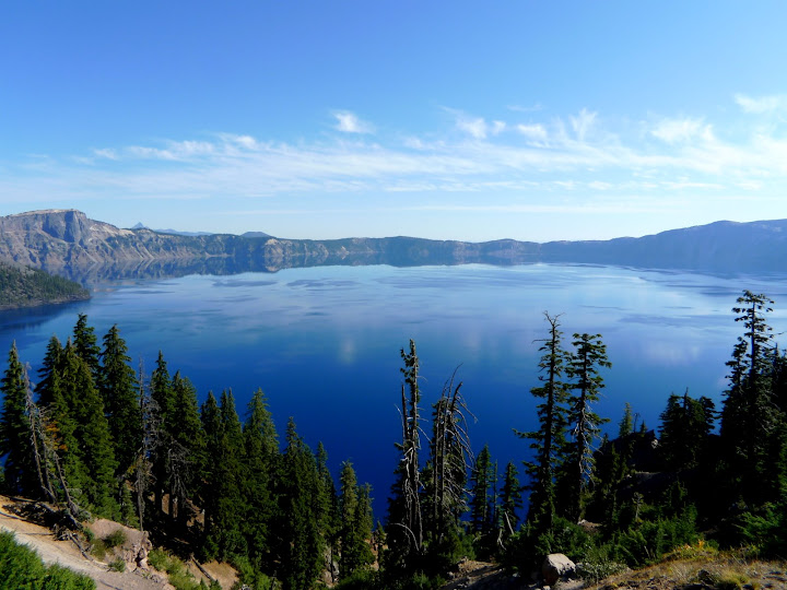
| 9/12 | Crater Lake | Visiting Crater Lake National Park, OR |
| 9/13 | Middletown | The last flight of the trip |
Some photos and videos from this trip
Zion National Park, UT (7/8)
Flying over Grand Canyon, Zion, and Bryce Canyon National Parks (7/12)
Flying over Capitol Reef and Canyonlands National Parks (7/13)
Canyonlands National Park, UT (7/15)
The nice grass runway at Durango, CO (7/17)
Soaring Museum in Moriarty, NM (7/20)
Santa Fe, NM (7/21)
Yellowstone National Park, WY (8/24)
Yellowstone National Park, WY (8/30)
Glacier National Park, MT (9/5)
Flying over Glacier National Park, MT (9/10)
Crater Lake National Park, OR (9/12)
A mountain wave flight in Middletown, CA (9/13)
Flying over Capitol Reef National Park. Very dry, but very beautiful land. My favorite feature is San Rafael Reef.
Flying over Grand Canyon.
More photos and videos can be found at my Picasa Web Albums and YouTube sites.
Sectional charts used for this trip

Sunday, September 13, 2009
The last flight of the trip
I had a very interesting last flight of this trip at Crazy Creek gliderport.
Crazy Creek gliderport is located only 60 miles from San Francisco. It has an unpaved but long runway dedicated to glider operations. It reminded me of King Mountain. There are small hills all around the runway, and it is easy to get the first lift over one of those hills.
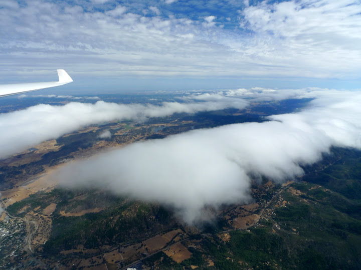
But today, we had waves. It didn't look like we had waves in the morning. There was almost no wind. But a few gliders reported that they were in a wave, so I flew up little before 2pm. Around 4,000 ft, I saw a couple of gliders (Ginny's G3 and Matt's 22T) flying back and forth, and they looked like flying in a wave, so I released there. But it turned out that they were just struggling and looking for lift. Without any other choice but to join them, I kept searching any sing of wave or whatever lift. I found something consistent, and managed to go up to 4,500 ft, but the wind was 8 kts from the west, so I thought that this was just a convergence. But then, Jim Indrebo reported that he was in a wave and at 7,000 ft a few miles south of where we were. So, after gaining another 500 ft, I headed south to see what was there. And indeed, there was a wave. I eventually climbed up to 9,000 ft in that wave, and that was the top. The wind was about 25 kts from the west at that point.
The unique thing about today's wave was, because we had so much moisture in the air, the clouds generated unbelievable view over the pacific ocean and the west coast. I was flying way above the clouds. It was a very interesting 3 hour flight.
Click here to view more photos of this flight.
 Flying over a gap between wave bars
 A surreal view
 Crazy Creek gliderport
Crazy Creek gliderport is located only 60 miles from San Francisco. It has an unpaved but long runway dedicated to glider operations. It reminded me of King Mountain. There are small hills all around the runway, and it is easy to get the first lift over one of those hills.
But today, we had waves. It didn't look like we had waves in the morning. There was almost no wind. But a few gliders reported that they were in a wave, so I flew up little before 2pm. Around 4,000 ft, I saw a couple of gliders (Ginny's G3 and Matt's 22T) flying back and forth, and they looked like flying in a wave, so I released there. But it turned out that they were just struggling and looking for lift. Without any other choice but to join them, I kept searching any sing of wave or whatever lift. I found something consistent, and managed to go up to 4,500 ft, but the wind was 8 kts from the west, so I thought that this was just a convergence. But then, Jim Indrebo reported that he was in a wave and at 7,000 ft a few miles south of where we were. So, after gaining another 500 ft, I headed south to see what was there. And indeed, there was a wave. I eventually climbed up to 9,000 ft in that wave, and that was the top. The wind was about 25 kts from the west at that point.
The unique thing about today's wave was, because we had so much moisture in the air, the clouds generated unbelievable view over the pacific ocean and the west coast. I was flying way above the clouds. It was a very interesting 3 hour flight.
Click here to view more photos of this flight.
 Flying over a gap between wave bars
 A surreal view
  Crazy Creek gliderport
Saturday, September 12, 2009
Going back to California (cont)
Spent a night at Bend airport, but left there early morning, and kept driving to Crazy Creek gliderport in Middletown, CA. I arrived at Crazy Creek around 6:30pm, and joined their BBQ event.
 Drove 436 miles
 Drove 436 miles
Friday, September 11, 2009
Going back to California
Drove from Kalispell to Bend, OR.
On hwy 97, there is no gas station from Biggs junction to Madras, OR. Actually, there are a couple of small ones in Grass Valley, but one was closed, and the other was member-only station. I almost ran out of gas!
 Drove 621 miles
On hwy 97, there is no gas station from Biggs junction to Madras, OR. Actually, there are a couple of small ones in Grass Valley, but one was closed, and the other was member-only station. I almost ran out of gas!
 Drove 621 miles
Thursday, September 10, 2009
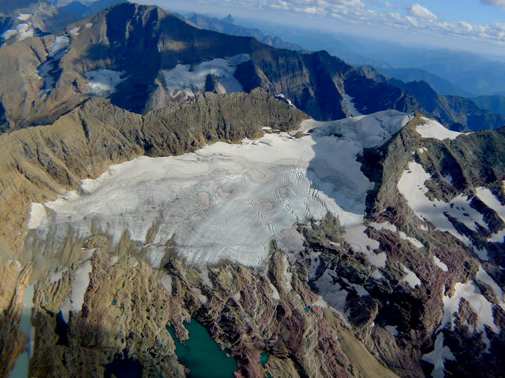
Flying over Glacier National Park
I wasn't supposed to fly today. Instead, I planned to hang around with Kevin Wayt, a glider friend of mine who happened to be in Kalispell. But we looked at sky around noon, and it looked too good to miss. Luckily, tow pilot was available, so I changed my mind and flew up.
On my way to 3,000 ft AGL, I already had a good feeling. After releasing, I headed to a cloud a few miles north of airport, found a lift without much trouble, and went up to 10,000 ft. I kept going north hoping to get to Eureka, a small town next to the Canadian border. But clouds ran out, so I jumped a valley to the east to fly over higher terrain which had more clouds. I went north several miles, and ran out of clouds again. I had to fly over a blue gap to go further north, but I wasn't perfectly sure if the clouds beyond the gap was on the US side or in Canada. Since I didn't want to greet Canadian airforce, I seeked the way to jump a valley again to the east to the even higher terrain. But the valley was totally blue, so I needed a trustable landout option in the valley to commit to the ridge east of it. I circled several times to try to identify a private airstrip named Langton shown on the sectional charge, but I couldn't find it. I punched in a few other nearby airports such as Crystal Lakes and Ryan. Crystal Lakes was about 20 miles and well within the range, but the ridge I was flying would block the path. Ryan was also within the range, but it was 25 miles away, and I would have to fly in the valley to get there (meaning that no lift can be expected). I circled and looked the map again and again, and finally found Langton. It was almost buried in the forest, but the runway looked to be in a good condition.
Gaining confidence, I committed to the ridge to the east which was also Glacier National Park's main ridge line. After gliding a few minutes in a quite air, I got to a cloud, and it was working greatly. I climbed back up to 11,000 ft, went north a few miles to hit the Canadian border. Actually, I stayed about 1 miles south of it just to be safe. There is a lake called Kintla Lake a mile south of the border, so I tried not to go north of it.
Took some pictures, and I followed the ridge to the south watching Chief Mountain on my left. According to the tour guide, it is a very holly mountain to native Indians. When a young man becomes an adult in their tribe, they'd send the man to the top of the mountain, and he prays and fasts for days and weeks until he sees his future (i.e. what occupation he should assume for his life).
I kept flying south to reach Lake McDonald. There are lots of glaciers around it, so I spent half an hour or so watching them and taking pictures. I also flew over Logan Pass, and watched Going to the Sun Mountain from sky. Going to the Sun Mountain is another holly mountain to the native Indians. According to the same tour guide, in the prehistoric time, a god of sun came down to the earth, and taught the Indians everything they needed to know to survive, such as how to raise crops, how to shelter from snow, etc. After teaching them all those good stuff, he climbed to the top of the mountain, and went back to the sun from there, hence the name Going to the Sun Mountain. This name is also used for the main road of the park (Going to the Sun Road) that goes through Logan Pass.
After watching enough glaciers, I kept going south, but realized that there aren't too many landout candidates in the south. The high ridges also made it difficult to see the glide path. So, I cut my way to the west flying over Hungry Horse Lake, and flew over to the center of Flathead Lake's before going back to Kalispell. It was a very nice 4.5-hour flight, and I was really glad I flew today.
Click here to view more photos of this flight.
 Mountains in Glacier National Park. Going to the Sun Road is seen in the middle of the mountain.
 Going to the Sun Mountain
 One of the largest glaciers Harrison Glacier
Tuesday, September 08, 2009
First flight at Kalispell, MT
Flew around 4 hours. I was ready to takeoff at 2pm, but tow plane had only Schweizer tow ring, and we spent 1 hour looking for TOST double ring. We finally found it, and I launched around 3pm. I found a good lift just north of airport, and went up to 10,000 ft, which was about the cloud base. I headed northeast towards Glacier National Park, but the wind picked up as strong as 22 kts from west, so I turned back. I caught another good thermal, went up to 10,500 ft again, and headed north this time. North didn't look too good either, so I headed east again towards Glacier National Park, this time following slightly northern course than before. I went further than before, but got low again, and turned west. Got back up to 10,500 ft again, and headed northeast gain towards Glacier National Park, this time taking a course somewhere between the two courses I tried earlier. This one worked best, I passed Lake McDonald, and got pretty close to Harrison Glacier and I was still at the cloudbase. Going to the next cloud would have given me an arena view of the glacier, but that would put me too close to the mountain peak, so I decided to stop there and turn back home. Besides, it was reall COLD. At this was the coldest flight I've had, even compared to many flights at 18,000 ft. My feet was almost freezing.
I had to fight 24 kts of headwind and lost quite an altitude before getting out of the park, but caught a good lift west side of the ridge where hwy 2 enters mountain area. There was a factory or something in a large black rectangular property, and it was generating a strong lift along the ridge surface. After gaining enough altitude to get back to Kalispell, I flew south along the ridge to see if there is any ridge lift. I was probably about 1,000 ft above the ridge, so it wans't really a ridge soaring, but I flew without loosing any altitude for 6 miles or so and back. On a west wind day, probably this ridge is a good reliable source of lift to get a final glide back to Kalispell.
Click here to view more photos of this flight.
 Harrison Glacier
 Flew 180km
Thursday, September 03, 2009
Driving to Kalispell, MT
Drove up hwy 93 to Kalispell, MT. At its latitude N 48º10'42.85", Kalispell City airport is the northernmost glider operation in the US. It's only 60 miles to Canada-US border.
 Drove 166 miles
 Drove 166 miles
Wednesday, September 02, 2009
Second flight at Hamilton
The day started earlier than yesterday, and was clearly a better day than yesterday. I launched around 2pm as soon as towplane became available. I went to the west ridge as yesterday. This time, I was able to catch the first lift easier, but boy, it was very rough. Those sharp pointing ridges produces very rough lift near the surface. It felt like riding a rodeo horse or riding submarine in a boiling water. I managed to get up 12,000 ft or so, and headed south hoping to make Salmon and back. The wind was southwest at 15 kts, so going to Salmon meant going upwind and easier way back.
But after I went 40 nautical miles south, the cloud density dropped, and they looked broken to the south from there. So, I diverted west where cloud density was still good to see how far I could go. But as soon as I went into the mountains for just 5 miles, I realized that I was in a tiger country. In front of me was all sharp pointing ridges without any view of the flat bottom. On the map, there were a few private strips some places and other, but not only I could not see them, I didn't know if I could make them with the altitude I had because the flight computer does not take those ridges into account. SeeYou Mobile does take terrains into account, but I wasn't sure how fine its terrain database's resolution was. The ridges were very sharp.
So, I turned east to see how the water tastes there. From yesterday's flight, I knew the mountains in the east were lower and roundish thus less promissing of lifts. But clouds were there, so I followed them. Actually, I found that this was much more fun than the west part of Hamilton soaring area. Because mountains are lower, I had more AGL, and there were enough decent airports (not private strips) to help safe landouts if necessary. After all, I went as east as 50 nautical miles from Hamilton airport, and saw Bowman and Dear-Lodge airports. Both had very nice paved runways. That was about 5pm, so I decided to head back before lifts died. There was a blue hole between Dear-Lodge and Hamilton, and I had only 2,000 ft above the glide path. Because of the mountains, I estimated that that did not give me enough ground clearance if I flew directly to Hamilton. So, I decided to go around the south following the path I came from, hoping to pick up the same lifts I used. But lifts were already weak there, and I went down as low as 10,500 ft but was still 50 nautical miles away from Hamilton. At this point, I was 500 ft below the glide path to Hamilton, and it was 5:30pm. I had a flashback of landouts at King Mountain and Logan, but this time, I had a luck with me, and made it back to Hamilton. I had 4,000 ft above the glide path when I crossed the hills east of airport, and figured out that I want at least 3,000 ft above the glide path to comfortably cross the hills. I landed around 7:30pm after flying 5.5 hours.
 Hills on the east were low and roundish
 Salmon River flows at the base of the valley
 Flew 340 km
Tuesday, September 01, 2009
First flight at Hamilton
It was sunny, but there were no clouds, so I waited until 2:30pm or so. When small Cu's started to cycle over the west ridges, I took my first tow at Hamilton. After releasing at 8,000 ft, I basically sled down for about 500 ft, but hit a good one just a mile or so uphill from the red house in mid hill. This lift gave me access to much higher and rocky ridges, and I went up to 11,000 ft or so. I headed south into the 10 kts of southwest wind, to connect to the real clouds developing there. But as soon as I got to a good looking one, rain hit me hard. Virga started to develop as I wandered around, so I turned north, and went 20 miles north of Hamilton where I couldn't find any more lift, and came back to Hamilton. It was a short 3-hour flight, but was good introduction to the area.
Hamilton is in a 15-mile wide valley, but the terrain on both sides are quite different. On the west side is very sharp mountains carved by glaciers. They have laser sharp pointing ridges and numerous beautiful small lakes between them. I found those ridges to be excellent thermal generators. Especially, peaks with three ridges extending outward from it, roughly 120 degrees apart, are good ones. They get sunlight all the time on one of its bowls, and they get wind all the time against one of the bowls. Contrarily, the east side is much roundish old-looking mountains. They are a couple of thousand feet lower than the mountains on the west. According to Shean, these mountains were basically soils carried by glaciers.
 A glacier valley west of Hamilton
 City of Hamilton and Hamilton airport
 Flew 170km
Monday, August 31, 2009
Driving from King Mountain to Hamilton, MT
Picked up my glider from King Mountain, and drove to Hamilton, MT. Hamilton is where Sean and Hank who towed us at King Mountain operate their glider ride and lesson businesses.
 Drove 226 miles
 Drove 226 miles
Sunday, August 23, 2009
Howe
On my way from King Mountain to Yellowstone, I dropped by Howe, one of the nearest landout site.
 Looking south from the north end
 Runway posts are about 1.5 ft high
 Runway post on the shoulder
 Gray and white barns
 Looking north from the south end
- The GPS coordinates in some turnpoint files is slightly off. The airfield is north of 3900N road, not south. Look for bluish and white barns which are at the south end of runway.
- The runway is gavel, but in good smooth condition.
- There is a windsock near the bluish barn.
- There is no obstacles on the approach lines on both ends.
- There is no graduation on the field.
- There are runway posts on both sides, but they are disguised in the bushes, and very hard to notice when landing. They are 58 ft apart.
- There are many fields suitable for landing around this field, but power lines are everywhere. Some fields looked big enough to land over the power lines.
- The town of Howe is 5 miles south of the airfield. Howe is an extremely small town with only 10 or so houses. There is no motel.
- Ground retrieve is easy. No gate, no tight turns, no gaps.
 Looking south from the north end
 Runway posts are about 1.5 ft high
 Runway post on the shoulder
 Gray and white barns
 Looking north from the south end
Glider safari enthusiasts' trailers
I left King Mountain around noon to spend a week at Yellowstone National Park.
Here are photos of a few trailers modified for gliding safari.


Here are photos of a few trailers modified for gliding safari.


Saturday, August 22, 2009
Taking rest
Yesterday, I flew 7 hours, and came back 2am, so I decided to take rest today.
In the evening, we had a dinner at the airport hosted by local cheerleaders.


In the evening, we had a dinner at the airport hosted by local cheerleaders.


Friday, August 21, 2009
Flight to Yellowstone National Park
Unfortunately, the missing glider was found as a wreckage near King Mountain. The crash made some press coverage article. When the crash was announced at the pilot meeting, there was a long moment of silence. I didn't know the pilot personally or met him in this safari because he flew out of a different airport nearby, but my heart goes to his family and friends.
The TFR was lifted early in the morning, so we cheered up ourselves, and flew.
The soaring condition was good. I launched third following Ramy and Matt&Ron's DG1000. Somehow, they got stuck near Mackay valley, but I was able to connect to the clouds east of Mackay (north of Howe). From there to Yellowstone National Park wasn't too difficult. There were a few gaps, but basically I followed clouds and reached Gardiner airport around 4:30pm. Some clouds started to overdevelop, but not all of them. There was 4 hours left until the sunset, so I thought there was a good chance to make it back home.
However, the ODs formed a line over the ridges, and I had to fly over lower grounds which had fewer and weaker thermals. I got pretty low northeast of Dubois, and at one point, I committed to Dubois and started the final glide there. But I was saved by a weak 1-2 kts, and backed up to 15,000 ft. But apparently, this was a mistake. I spent too much time getting high, and by the time I made halfway to King Mountain from there, I realized that I won't make it home or bust the sunset time. I had Mud Lake and barely Howe in the glide. By looking at the chart, Mud Lake looked more civilized, so I landed there at 8:23pm. Ramy joined me north of Dubois, eventually made it back to King Mountain. The difference was that he cut the weak thermal at 14,000 ft, and kept moving on.
Mud Lake turned out to be a good airport to land. The pavement was in good condition. The runway has runway numbers and a windsock. Apparently, it was actively used for cropdusting. However, the runway was very narrow. It was the narrowest runway I have landed. If I put one wing tip on the paved surface, the other wing tip would be over a soft shoulder. And there were runway lights on both sides. I didn't have any troubles landing there, but probably, I do not want to take off there if there is a crosswind.
Cellphone worked, so I called John first to let him know that I was safe and okay, and then called Bill to ask if he could bring me back to King Mountain. I was thinking of doing self-retrieve, but Bill kindly offered me to bring my glider trailer so that we could do the retrieve in one pass. Bill and Yuliy arrived at Mud Lake airport around 11pm. While waiting, a neighbor Aike found me standing on a dark road side, and invited me to his house. With food, beverages, and shelter, I was able to wait comfortably.
We were back to King Mountain around 2am. Big thanks to Bill and Yuliy!
 Gardiner airport and Yellowstone river
 Flew 559km
Thursday, August 20, 2009
No flight at King Mountain
To avoid interfering with the search and rescue effort, glider operations at King Mountain Glider Park was suspended for the day. Yuliy, Bill, and me went to Yellowstone National Park.
Wednesday, August 19, 2009
A tough day
We started launching around noon, but it was very hard to catch the first lift. The day finally started to kick around 2pm. I scratched ridges on the west side of King Mountain for a long time before finally finding something just over the airfield. After climbing to 13,000 ft, first I went north, and turned Borah Peak. When I turned it, I was barely above the ridge, and spotted an American flag on the very top of the ridge. Then I headed south, came back to King Mountain, and saw some clouds towards Big Southern Butte, so I decided to go there. On my way, I flew over semi-restricted area which reportedly has a factory for nuclear power generator for submarines. The world's first nuclear reactor is also in the same area, I heard. After turning Big Southern Butte, I momentarily lost glide to King Mountain, but worked out convergence lift, and came back to King Mountain with some extra altitude. I used it to climb up again over King, ventured out to west a bit, and landed after flygint 4.5 hours. The day was mostly blue. There were some Cu's but they were cycling so quickly that, by the time they formed, it was too late to go there.
After most people landed, we learned that a pilot and his glider did not come back to the airport as planned. John initiated search and rescue effort with multiple agencies.
At night, we all went to Sissy's Ram's Horn restaurant, and enjoyed baby back rib dinner.
 Pilot meeting in the morning
 Big Lost River
 Big Southern Butte
Subscribe to:
Posts (Atom)